Devastating Super-Cell Storms August 2023 Over Bavaria

August 2023 saw extreme weather events in Middle Europe. It wasn’t so many events, but a couple of significant storms. A number of super cells in Germany led to damage. There were some typical weather patterns in Upper Bavaria along the alps, where notorious hail-stripes are well-known, but the intensity of extreme weather was surprising.

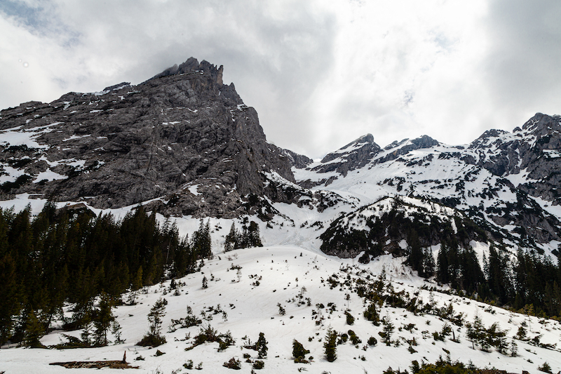
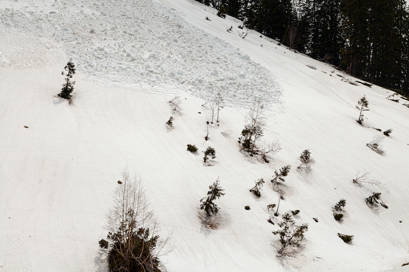
One of the most significant extreme weather events happend on August 26 in the afternoon. Two supercells brought incredible amounts of hail in Southern Germany. A number of 123 places were affected, according to German Weather Service DVD. The separate weather systems rolling over Bavaria with a distance of 100 km. The two super-cells left a trail of destruction at a length of 130 km. The strip of hail had a width of 15 km. In that zone there was a lot of destruction in Benediktbeuern with a well-know monastery and Bad Bayersoyen. In some places hail had diameters more then 5cm, which turns them into bullets with high speed. Between the strips there was no such destruction but strong gusts of wind. The maps of the Europan Severe Weather Database deliver an impression of the two trails of destruction.

Heavy Thunderstorm on August 13 with intense lightning

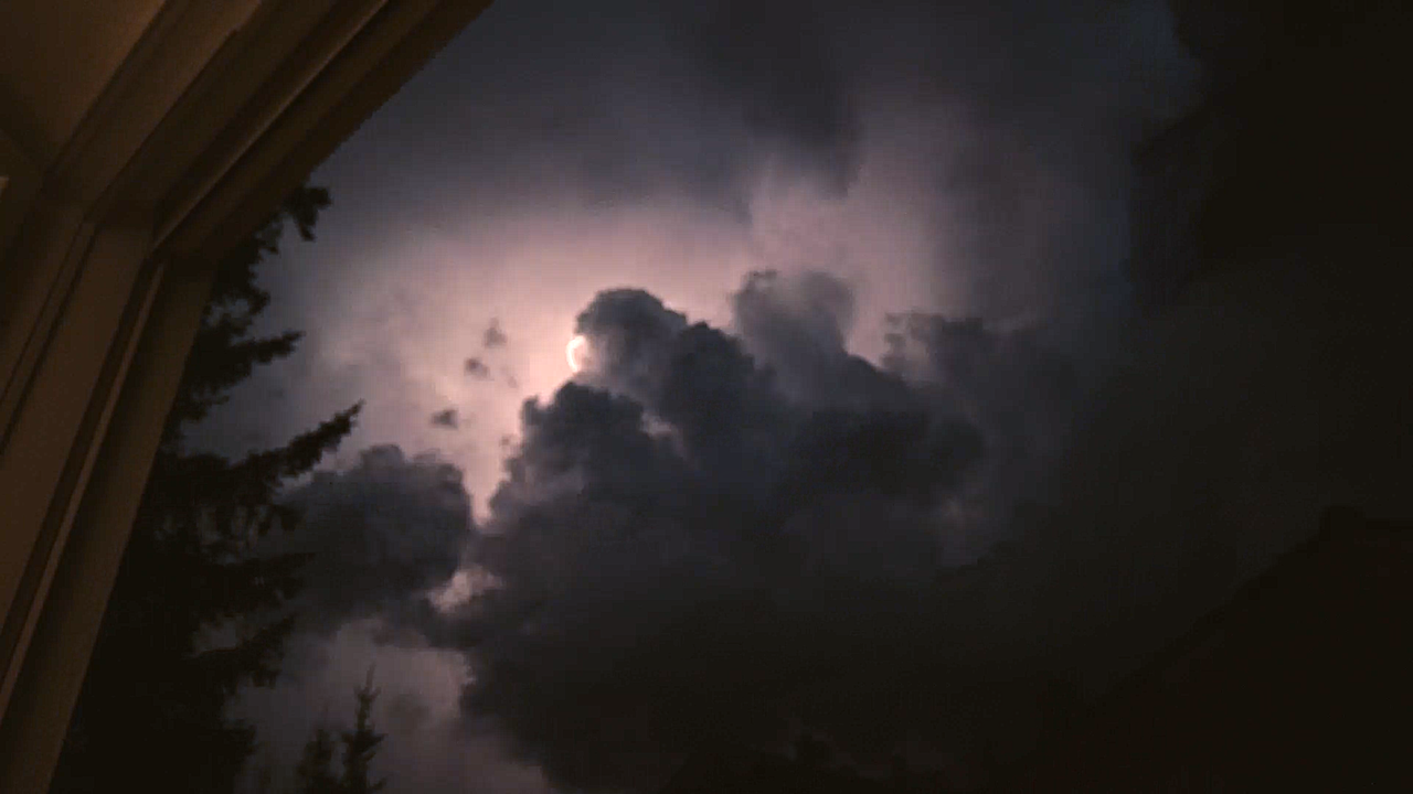
Before these events, there were also heavy thunderstorms on August 13. These storms were coming from Baden-Wurttemburg. The video on the stormypictures.de Youtube Channel shows how the storm quickly intensifies. There was also a remarkable amount of lightning. The immense rate of lightning lit the sky and lasted unusually long.

There are no fundamental new weather patterns here, but what happened is what climate-researchers predicted a long time ago. A hotter and wetter atmosphere contains more energy. This energy is a precondition for stronger storms as these super-cells. And it is not only a warmer atmosphere. Early this year, researchers detected unusual warm surface temperatures in the oceans for example the atlantic ocean near Florida.

Here is the development of the thunderstorm in the early evening hours of August 13 in Upper Bavaria, close to lake Ammersee:

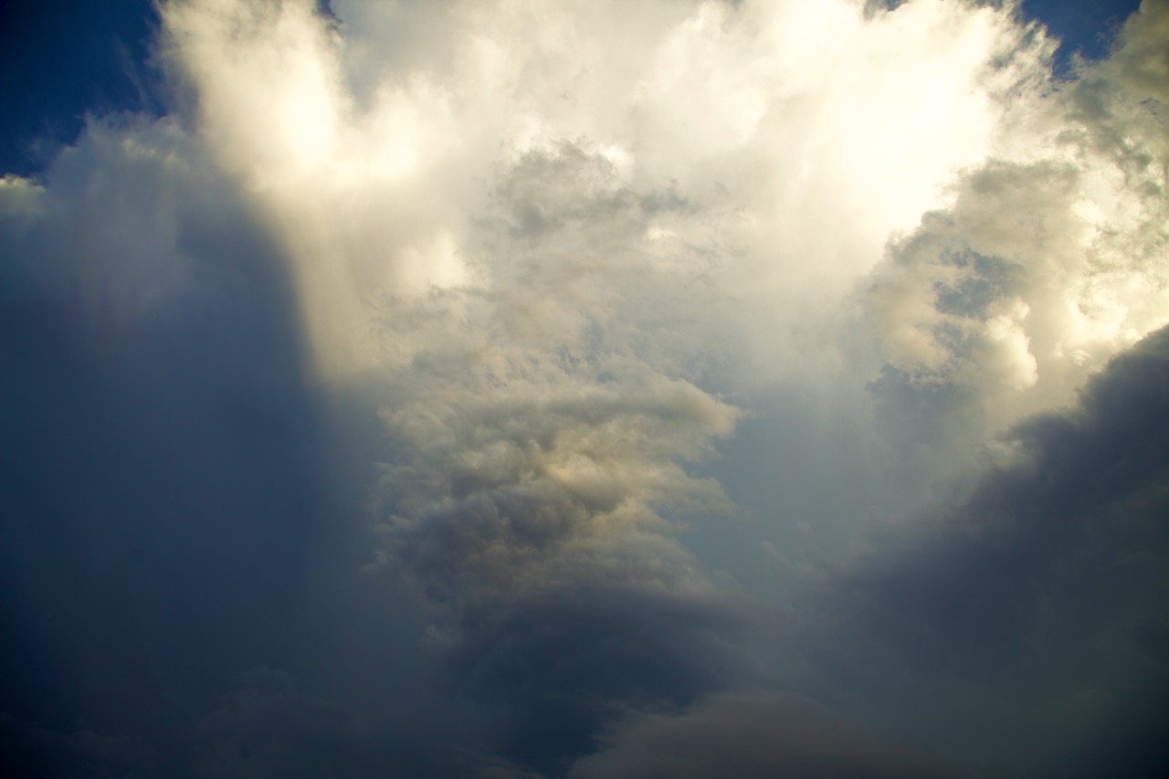
The late sun illuminates towering thunderstorm clouds

At first sight the huge tower of clouds looked  impressive but not as monstrous it became.

There was an incredible dynamic in the chaotic atmosphere

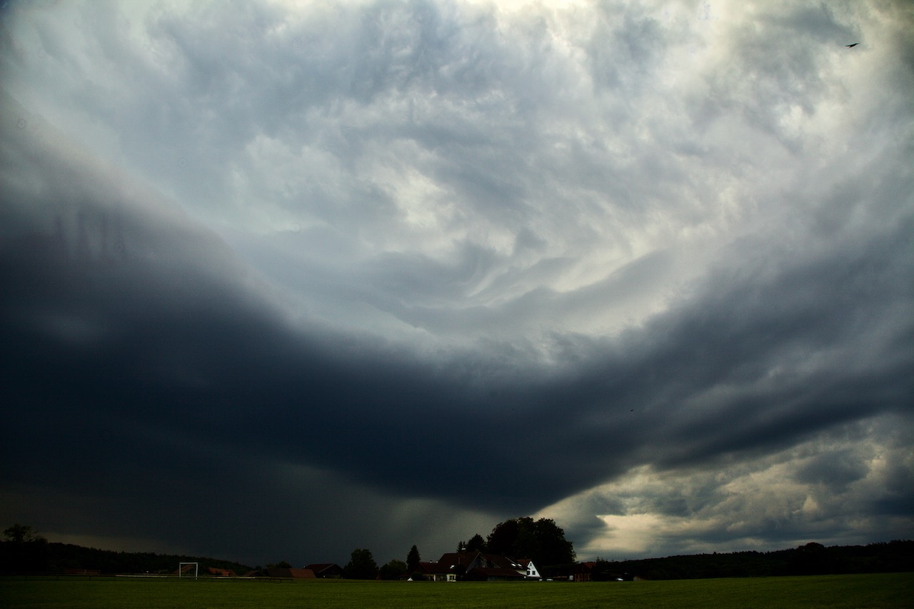
Within minutes the sky changes and dark clouds approached fast. In the upper half a rotating pattern appeared.

Lighting strikes came close very fast and a huge curtain with fall stripes appeared.

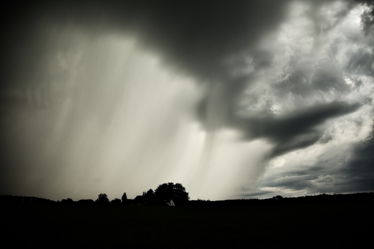
This storm brought intense rain and hail in some places. Later there was intense lightning.

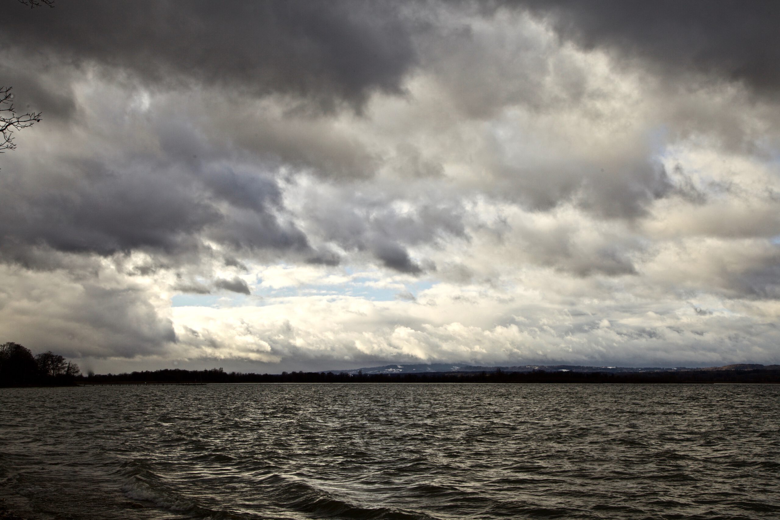
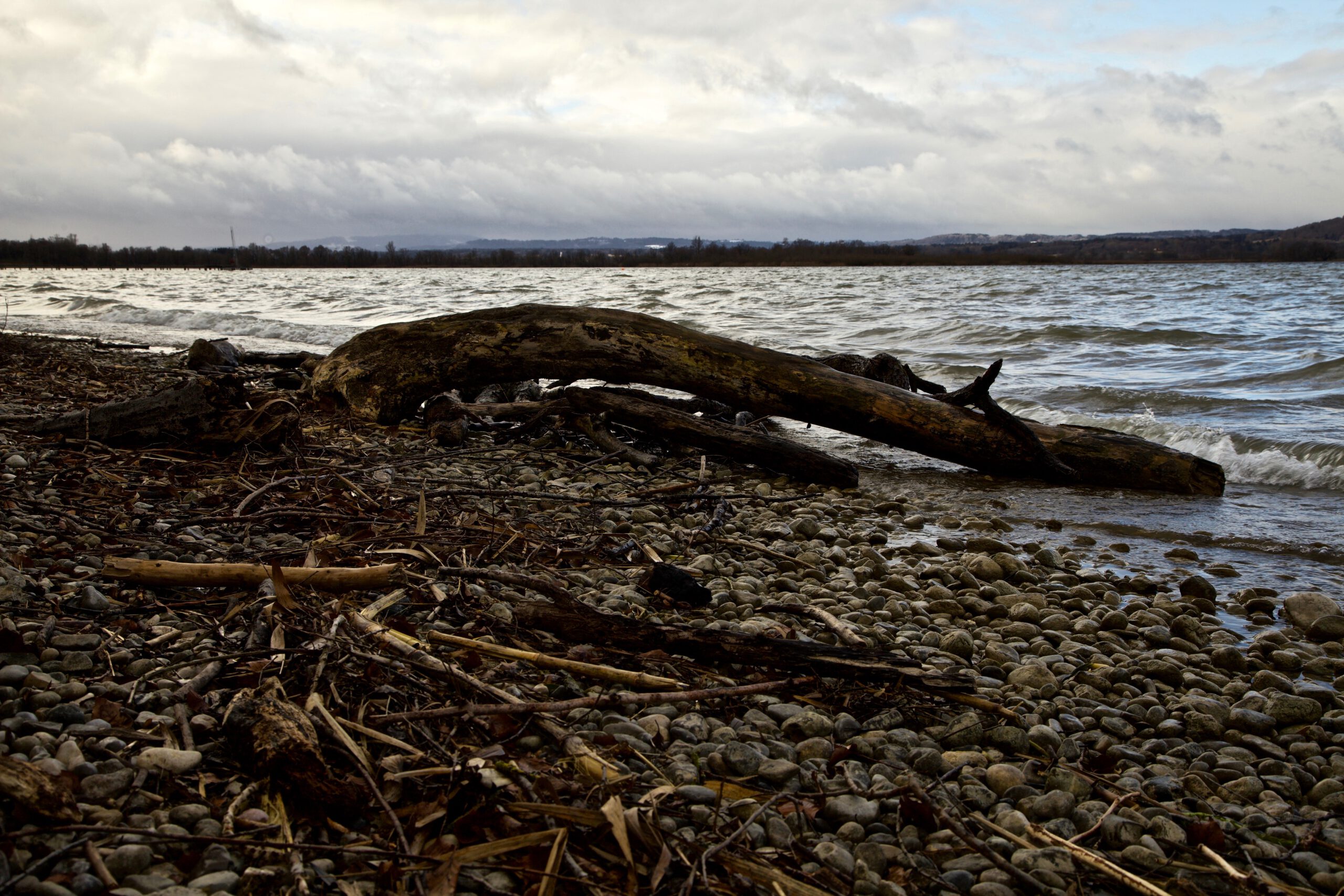
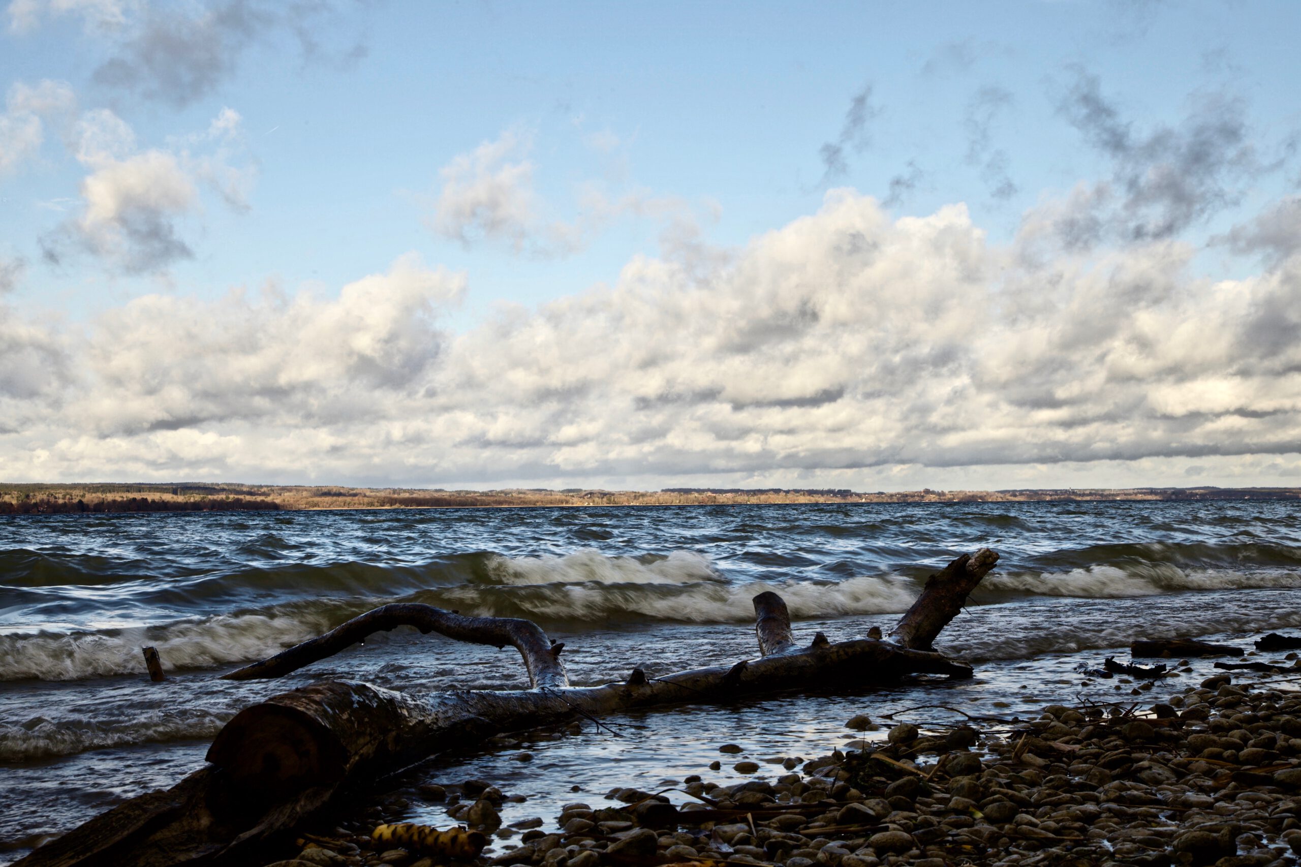
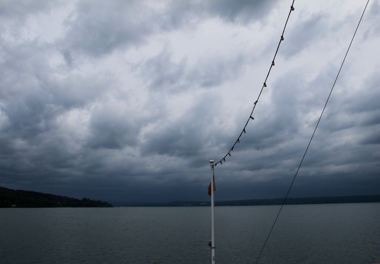
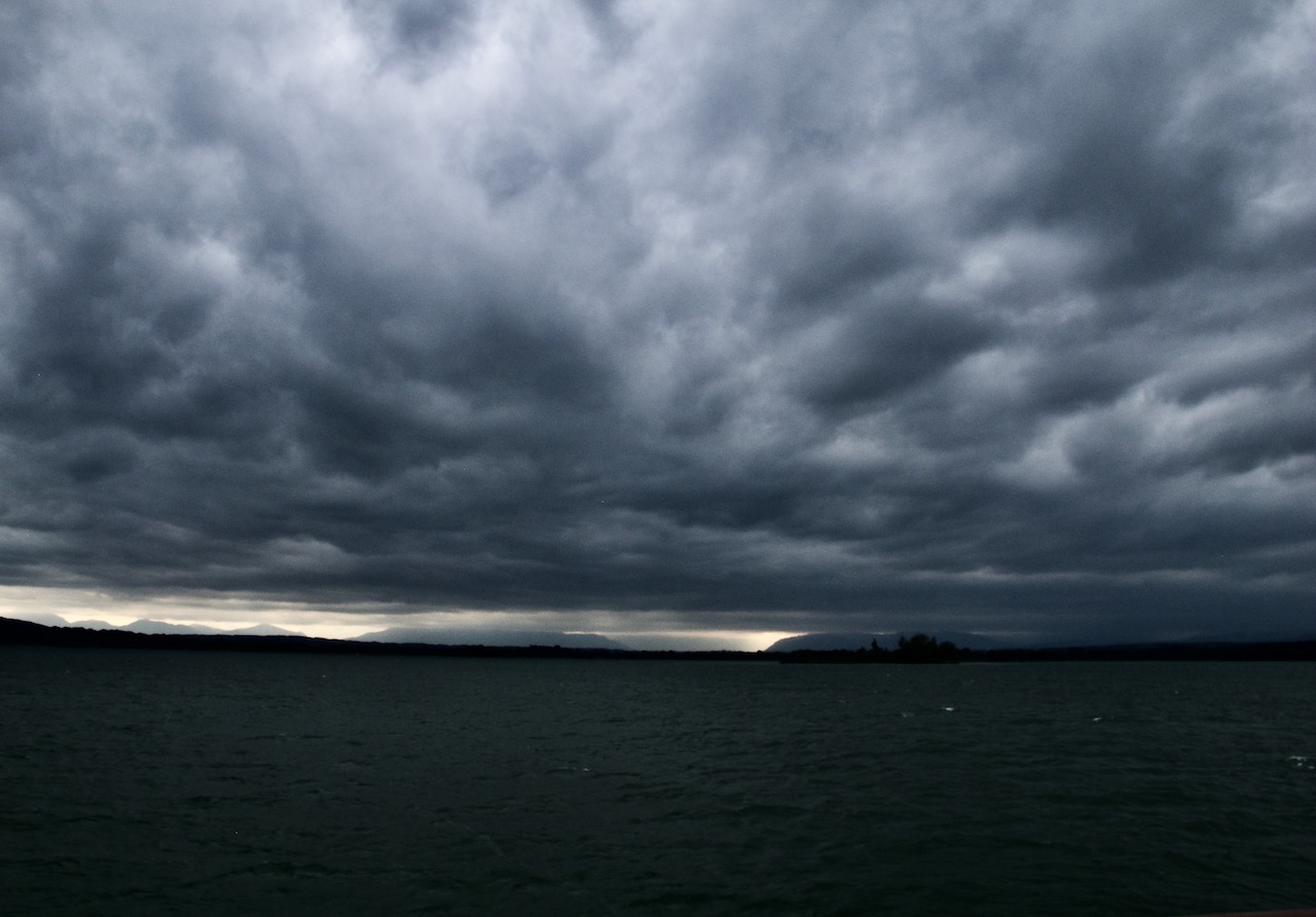
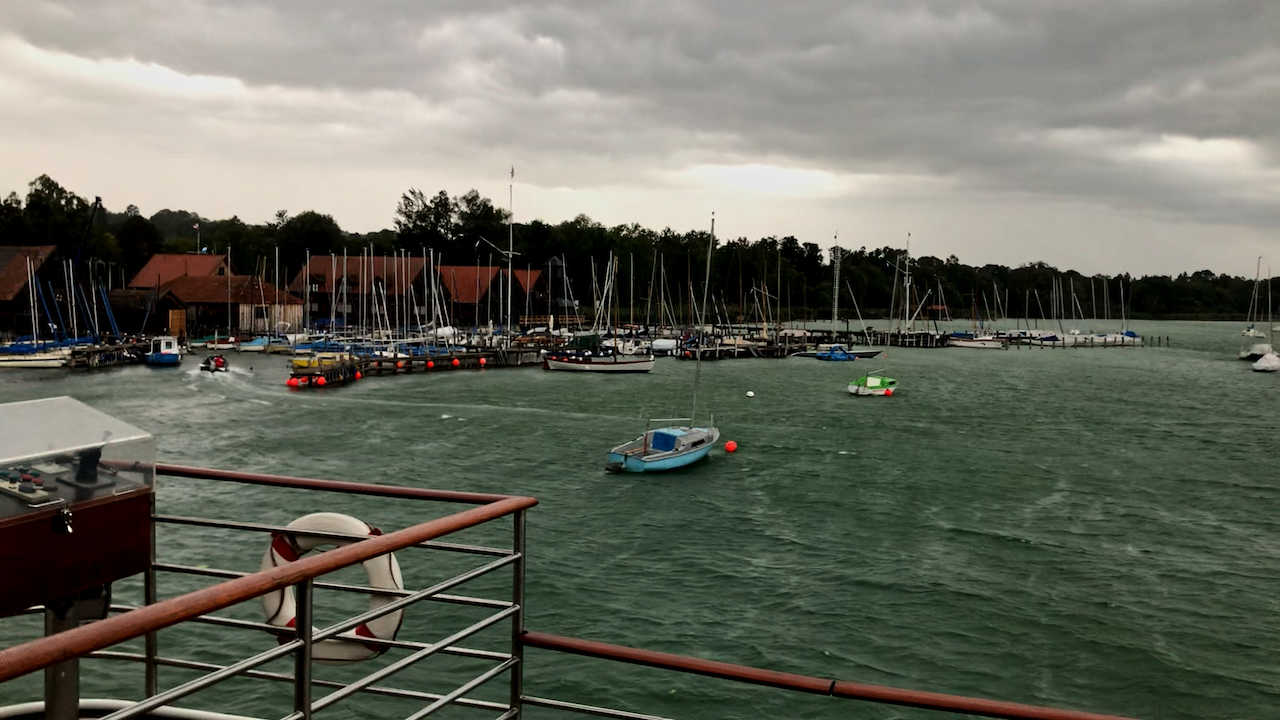
The supercell storms on August 26 seen from a ship on a lake

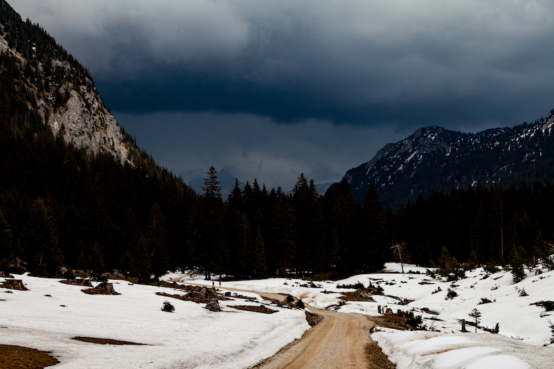
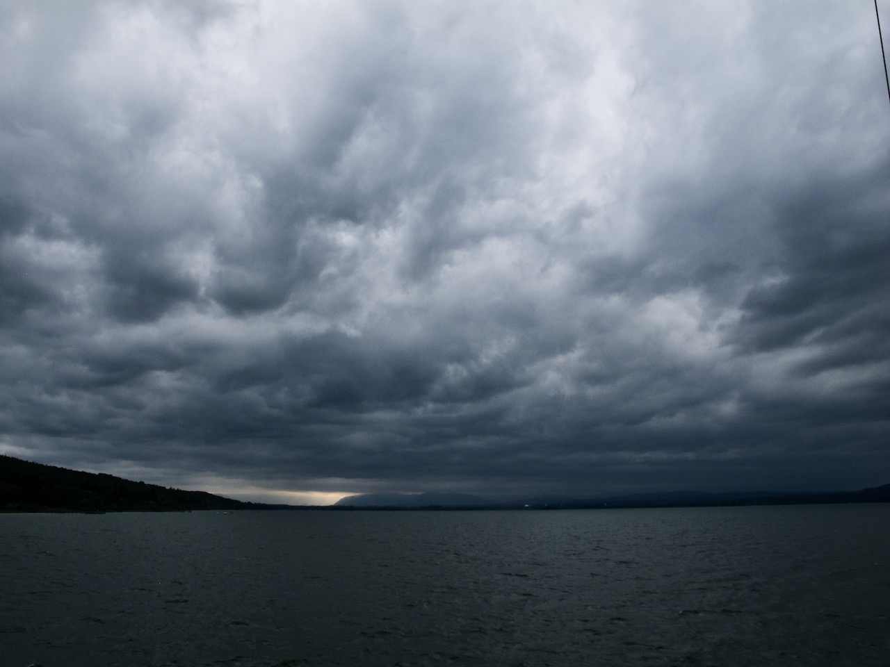
There had been further dramatic weather events after August 13. On August 17 a monster thunderstorm set parts of Nuremberg in Northern Bavaria under water after a flash flood. The series of severe weather peaked on August 26 with the two super cells in Southern Bavaria and also dangerous thunderstorms in between. The pictures below were taken on a ship on Lake Ammersee. Here it was very hot and the sky was clear til middle of the afternoon. Then, dark clouds were arriving very fast. The orange flashing lights on the storm warning lights were activated. It was important that sailors headed back to harbour in time because the line of thunderstorms arrived fast with strong winds and rainfall later.

An unusual sight

Weather is always unique. Compared to the previous thunderstorms, the sky “looked” more like it was typical rain clouds. However these was a severe weather system at any place. The wind picked up very fast and the normally peaceful lake turned into a raging water with remarkable waves. Strong rainfall let the shore disappear in a sort of mist minutes after the wind gusts appeared. Later the evening, the weather calmed down. However the damage in many regions was dramatic.

Dark clouds approaching from South-West

The clouds quickly become darker.

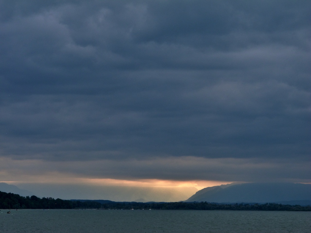
Still some sunshine in the Alps before the super cell system arrives

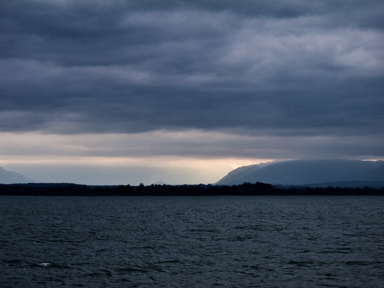
It’s getting pretty dark even during the afternoon.

Gusts of storm at the westside of Lake Ammersee in Bavaria. A motor boat makes it barely into the harbour.

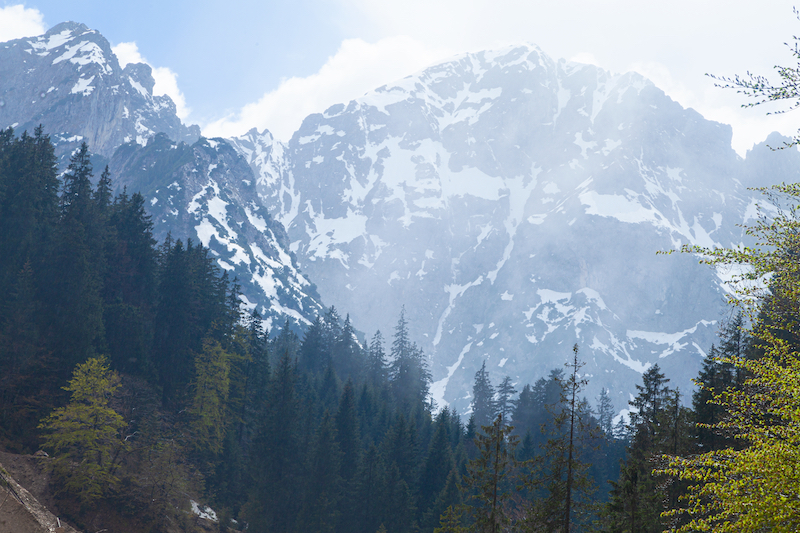
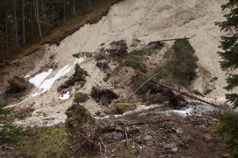
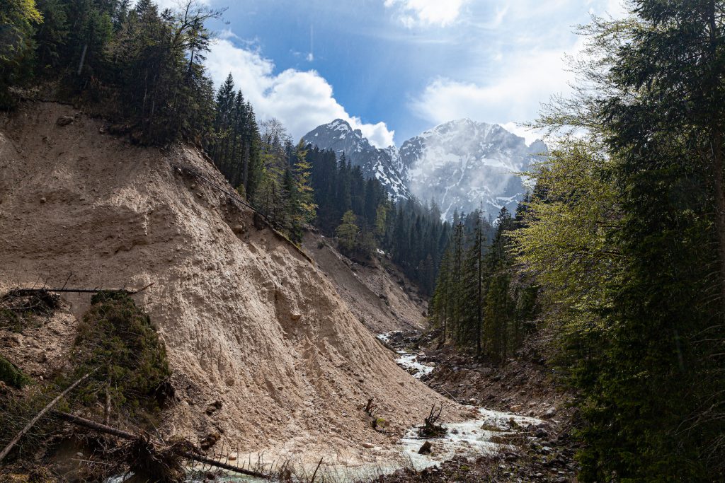
What came after the storm

The super cell weather systems were the harbingers of more extreme weather in the alps. The days later there was heavy rain and a flood created more damage in Austria. On August 28 the famous Oetztal was cut off from the outer world after a mudslide destroyed the only road. Many tourists could only leave via the Timmelsjoch mountain pass. Helicopter’s brought food and other stuff into the valley.

Only days later a high pressure system brought calm and unusually warm weather in September. The super cell storms and the following devastating floods were dire reminders what living in a new climate triggered by climate change means. It means coping with a different world, less comfortable, more unpredictable and more violent. August 2023 was also one of the hottest summers on record.

Winter Storm Nadia, January 30, 2022

End of January shores at the Northern Sea and stretches in different countries were hit by winter storm Nadia. This was a low pressure system which changed weather condition in Germany after a quiet period with high pressure. Most of the days there were low hanging mist, some snowfall and lots of sun in the Alps. The weather change is not unusual for this time of the year. Winter Storm Nadia did serious damage on the island Langeroog, Hamburg and Berlin. In Langeroog the sand of a shore was swept away and what was left was some kind of newborn cliff.

Windy Sunday Morning: Fast moving clouds, waves and snow on the hills in the background

In Southern Germany there was a windy night between January 29 and January 30. The wind calmed down a bit in the morning of Sunday, January 30. There were moderate winds at the Lake Ammersee. Temperatures were up a bit after some cold days. The snow remained in the higher places of Upper Bavaria. As often there were interesting atmospheres and cloud patterns during that stormy winter day. Even the wind was only moderate on the ground, the clouds were moving fast. It was a quick change of conditions with sunlight and overcast sky. The air was very clear This is always a condition after a storm and very useful for taking pictures or taking videos.

The winter times and morning hours are also a good time for pictures and videos, since the sun is not heigh up in the sky. Therefore there are interesting cloud colours and a crisp blue sky between the fast moving clouds. It is good to avoid walks through forest even after a frontline or a storm has passed. Open places like meadows, hills or the shoreline of a lake are safer places to capture some pictures.

Driftwood after the storm night

The shoreline on the Eastside of the lake Ammersee, the second biggest lake of the so-called “Fünf-Seen-Land” south of Munich is a popular spot for photographers. It is close to the nature reserve “Ammersee West” and there is a sense of wilderness there. There is always driftwood and whole trees scattered around. If the branches or trees last longer in the water they can turn into sculptures. Nature is an artist here.

Thus it was the idea to take a stroll at the shore of lake Ammersee near that nature reserve and take some pics with the fast moving clouds on Sunday morning. It was only a quieter moment between two storm systems. The wind was taking up again on Monday, January 31. Temperatures dropped again and snow as falling. Series of storms are not unusual for this period of the year. However, we see now unusual extremes at any time of the years in some parts of the world. Whereas winter storm Nadia was more or less a “normal” storm, the U.S. was hit by extreme winter conditions. the same time.

After a cloudy morning there were more and more blue skies. In January the winter sky has that special blue color. After the front had passed the day before it was dry til the next day. Wind and waves changing the appearance of this special shore all the time.

Peter Engelmann, 31.01.2022

Wildromantisches Tiroler Tal nach einem schweren Winter


Musau, Österreich, 19. Mai 2019

Im April 2019 mehrten sich in Europa Befürchtungen, dass sich 2019 das extreme Wetter mit einer Hitzewelle in vielen Regionen wiederholen könnte. Zum Glück kehrte das Wettergeschehen im Mai 2019 zur Normalität mit Regen und kühleren Temperaturen zurück. Anders als in anderen Ländern gab es in den Alpen im Winter 2018/19 jede Menge Niederschlag. In manchen Ecken sogar Unmengen an Schnee. Zerstörerische Lawinen bedrohten Täler, zum Beispiel in Balderschwang. Starke Stürme richteten zudem schwere Schäden in den Bergwäldern an.

Ein Trip in die Alpen im Mai ist immer faszinierend. Besonders nach einer Periode mit den oben genannten Wetterextremen. In den höheren Regionen kann eine Wanderung im Sommer mit grünen Wiesen und warmen Temperaturen beginnen, aber der Winter ist nicht weit. Es ist auch eine Chance die enormen Kräfte in der Natur zu sehen. Es ist die Zeit gewaltiger Schmelzwasser, wenn große Schneemengen rasch abschmelzen. Und der letzte Winter hat viele Spuren hinterlassen: Die Natur beginnt sich gerade von den Lawinen zu erholen, und im Wald sieht man das zerstörerische Werk der Winterstürme.

Der Frühling kommt spät in den Bergen. Es ist eine kurze Zeit, in der das Leben in die gefrorene Welt zurückkehrt. Es ist eine Zeit, in der man sowohl unglaubliche Schönheit wie auch die zerstörerische Kraft der Elemente sehen kann.

Das Reintal bei Musau in Tirol bietet alles. Es ist perfekt für einen Ausflug und gut erreichbar. In den nördlichen Alpen ist es eines der beeindruckendsten Täler. Steile Felswände, ein wilder Bergbach, ein naturbelassener Wald und die hohen Gipfel der Allgäuer Alpen machen es zu einer unvergleichlichen Erfahrung.

In Musau gibt es sowohl eine Bahnstation wie auch einen Parkplatz, die “Bärenfalle” am Beginn des Wanderwegs. Die erste halbe Stunde des Weges führt durch den Wald und ist ein strammer Anstieg. Nach einer Weile erreicht der Weg die ersten Aussichtspunkte und die Berggipfel werden sichtbar.

Der 19. Mai, ein Sonntag, begann als sonniger und leichtbewölkter Tag. Jedoch gab es eine Unwetterwarnung. Es sollte sogar schon am Vormittag Gewitter geben. Doch das gute Wetter hielt länger als erwartet.

Majestätische Berge im Hintergrund
Bergwald im Reintal

Der Wanderweg ist auch eine Forststraße, die das Dorf mit der Musauer Alm, der Otto Mayr Hütte und der Füssener Hütte verbindet.

Forststraße im Reintal
Frühlingsblumen

Nach einer circa eineinhalbstündigen Wanderung kommt die Musauer Alm in den Blick. Es ist eine perfekte Gelegenheit für eine Pause mit gutem Essen in einer sehr freundlichen Atmosphäre. Nach dieser Pause zur Mittagszeit sah das Wetter zunächst immer noch gut aus. Aber in den Bergen muss man immer wachsam sein. Die Verhältnisse können sich blitzschnell ändern.

Musauer Alm

Hinter der Musauer Alm führt der Weg höher in das Tal hinauf. Hier ändert sich die Szenerie komplett. Statt des romantischen, grünen Tals sah es dort aus wie auf einem Schlachtfeld der Naturkräfte aus. Umgestürzte Bäume, die Reste einer Lawine und immer noch große Schneefelder hinterließen einen tiefen Eindruck. Man kann sehen, wie ein schwerer Winter in den Alpen das Gesicht der Landschaft verändert.

Nach dem schweren Winter
Lawine
Immer noch eine Menge Schnee.

Am Nachmittag wurde es auf einmal von Osten her dunkel. Eine Regenfront mit einem Gewitter näherte sich. Zeit rasch umzukehren.

Ankunft eines Gewitters in den Bergen.

Schneller als erwartet, erschien nach dem starken Regenschauer die Sonne wieder. Jetzt zeigte sich die Landschaft in besonders magischer Weise.

Winter und Sommer zur selben Zeit

Es ergab sich auch noch die Möglichkeit,die Folgen der Erosion am Sababach anzusehen. Regen und harte Witterungsbedingungen führen hier zum Abbruch der Felskante.

Massive Zerstörungen

Erosion am Sababach”

Später am Nachmittag war es bedeckt. Nach dem Regen stieg Nebel vom Wald aus auf. Es war eine komplett andere mystische Atmosphäre. Da zeigte sich wieder einmal, dass regnerisches Wetter oft am interessantesten für dramatische Bergbilder ist.

Regenwolken und grüne Bäume

Das nasse Wetter lockte ein seltenes Tier hervor: den Alpensalamander.

Salamander

Das spektakuläre Tal mit der Musauer Alm ist nicht weit von der bekannten Stadt Füssen mit dem berühmten Schloß Neuschwanstein entfernt. Auf der österreichischen Seite liegt Reutte und die Lechtalregion in der Nähe. Das Lechtal ist eine der letzten Wildflußlandschaften in Europa. Dort gibt es verschiedene Waldarten, eine große Artenvielfalt und weitere beeindruckende Bergszenerien.

An manchen Orten gab es am 19 Mai tatsächlich Unwetter. In Ostdeutschland führte Starkregen zu kurzzeitigen Überflutungen. Es war der Beginn einer längeren Regenperiode mit Hochwasser in Teilen Süddeutschlands. Das ist für Mai nicht ungewöhnlich. 1999 und 2005 gab es gewaltige und zerstörerische Hochwasser. Das Hochwasserereignis 1999 war Anlass für zahlreiche Schutzmaßnahmen, zum Beispiel in Garmisch-Partenkirchen in Oberbayern.

Wild Tyrolean Valley After Severe Winter


Musau, Austria, May 19, 2019

In April 2019 there were many fears in Central Europe that 2019 would repeat its extreme weather patterns with a drought in many parts of Germany. Luckily, in May 2019 weather turned back to normal patterns with rain and colder temperatures. Unlike other areas, there had been a lot of precipitation in the Alps during winter 2018/2019. In some places, there were tons of snow. Devastating avalanches threatened some alpine valleys. There had also been some storms which did severe damage in the mountain forest.

A trip into the Alps in May is a fascinating thing. Particularly after a period with the above-mentioned weather extremes. In the higher regions, a hike can begin in “summer” with green meadows and warm temperatures but winter isn’t very far. It is also a chance to see the power of nature. It is the time of devastating thaws when the huge mass of snow melts quickly. And there are many traces of this last winter: Nature is recovering from avalanches and in the mountain forest we see the destructive force of severe storms.

Spring happens late in the mountains. It is a short time span when life returns to the frozen world. It is time to experience both the destructive power of the elements and its incredible beauty.

The Rein valley near Musau in Tyrol offers it all. It is perfect for a trip and is easily accessible. It is one of the most impressive valleys in the Northern Alps. Steep Rock faces, a raging river, a very natural forest and high peaks of the “Allgäuer Berge” makes it an unparalleled experience.

In Musau there is both a train station but also a parking spot, “Bärenfalle” at the beginning of the hike. The first half hour of the walk is in the forest and a steep ascent. After a while, the trail reaches the first vantage points. The peaks of the mountains become visible.

Sunday, May 19, started as a sunny and slightly cloudy day. However, there was a severe weather warning in place. It was said that thunderstorms would already occur before noon. The good weather lasted longer as expected.

Majestic Mountains in the background.
Mountain Forest In The Rein Valley

The trail is also a forest road which connects the village with the Musauer Alm and the Cabins, the Otto Mayr Hütte and the Füssener Hütte.

Road In The Rein Valley
Spring Flowers

After approximately one and a half hour of walking the cosy Musauer Alm comes into sight. It is the perfect opportunity for a stop and getting some good food in a very friendly atmosphere. After the stop which was in the middle of the day, the weather still looked fine. It seemed that the weather forecast wasn’t right. But in the mountains, you need to be very attentive and conditions can change very quickly.

Musauer Alm

Behind the Musauer Alm, the trail leads higher up into the valley. Here the image changed completely. Instead of the romantic green valley, it looked more and more like a battlefield of the forces of nature. Overturned trees, the remains of an avalanche and huge fields of snow left a deep impression. One could see what the severe winter in the alps did. In some places, it changed the face of the landscape.

After the severe winter
Avalanche
There is still a lot of snow.

Then it happened. It wasn’t too long and early afternoon when the weather changed completely. Rain and thunderstorm clouds appeared quickly from the east. It was time to turn around and head back down into the valley.

Arrival Of A Thunderstorm In The Mountains.

Faster than expected the sun appeared again after a heavy rain shower and some thunder in the clouds. It was then when there was a special magic in the landscape.

Winter And Summer At The Same Time

It was also an opportunity to study the work of erosion near the river. Rain and tough conditions led to mudslides and other destruction.

Massive Destruction

Erosion near the “Saba Bach”

Later in the afternoon, the sky was overcast. After the rain mist ascended from the forest. It was a completely different, more mystical air. It proved again that rainy weather is often the most interesting weather condition for dramatic pictures in the mountains.

Rain Clouds and The Green Trees

The wet weather attracted also a special animal, which is rare to see. The black salamander.

Salamander

The spectacular valley and the Musauer Alm is not far from the famous town of Füssen (with the prominent Neuschwanstein castle). On the Austrian side, Reutte and the “Lechtal-Region isn’t far. The Lechtal with the river Lech is one of Europe’s last river wilderness regions. It contains different types of forest, rich animal life and more spectacular mountain sceneries.

In some places, there was indeed severe weather on May 19. In East-Germany flooding was reported and there were heavy thunderstorms. It was also the beginning of a long rainy period with some flooding in Southern Germany. This is not unusual for May. In 1999 and 2005 there were floods which led to a lot of destruction. The events of 1999 gave reason to improve precautions against flooding for example in Garmisch-Partenkirchen in Upper Bavaria.