An Alpine Wilderness Easy Accessible For Landscape Photography – Oy Valley

by Peter Engelmann, April 30, 2022

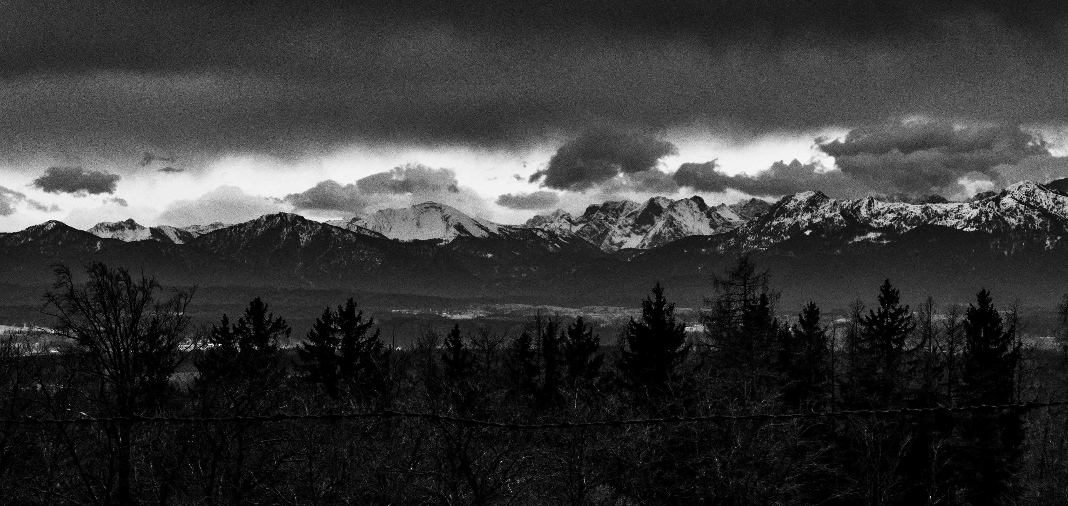
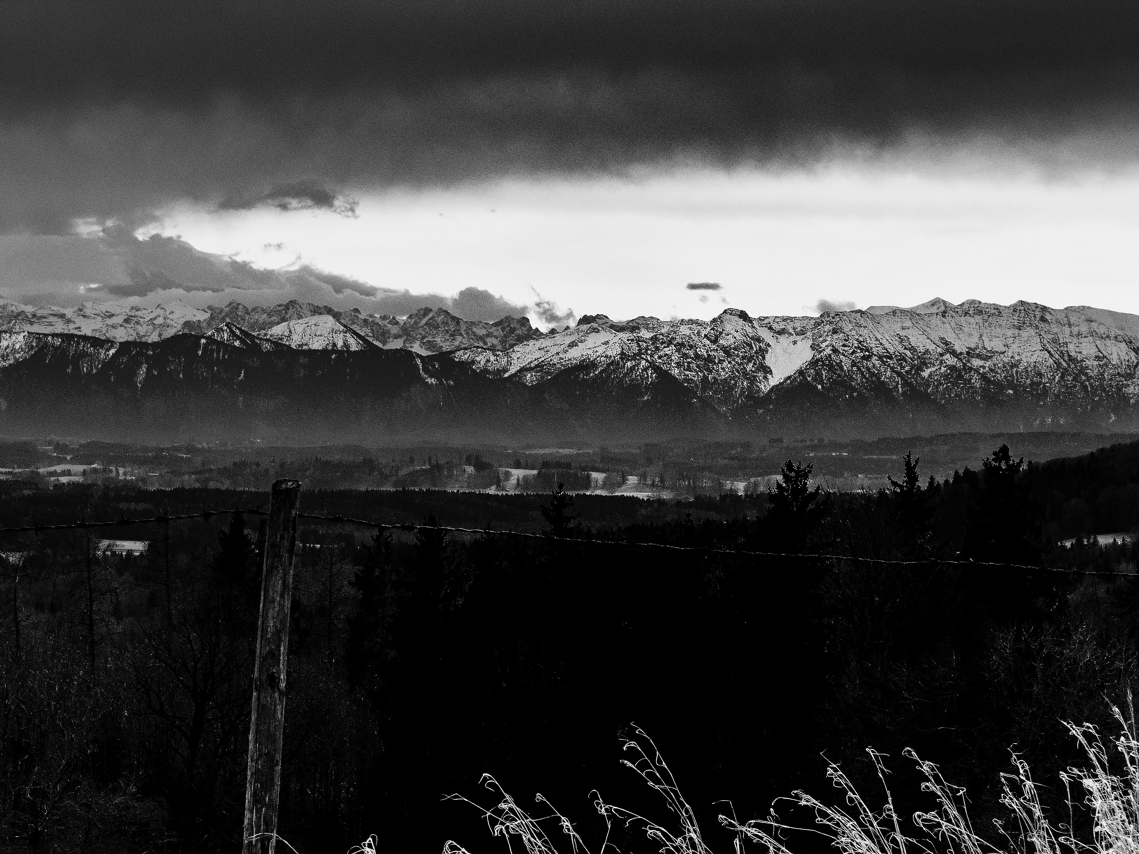
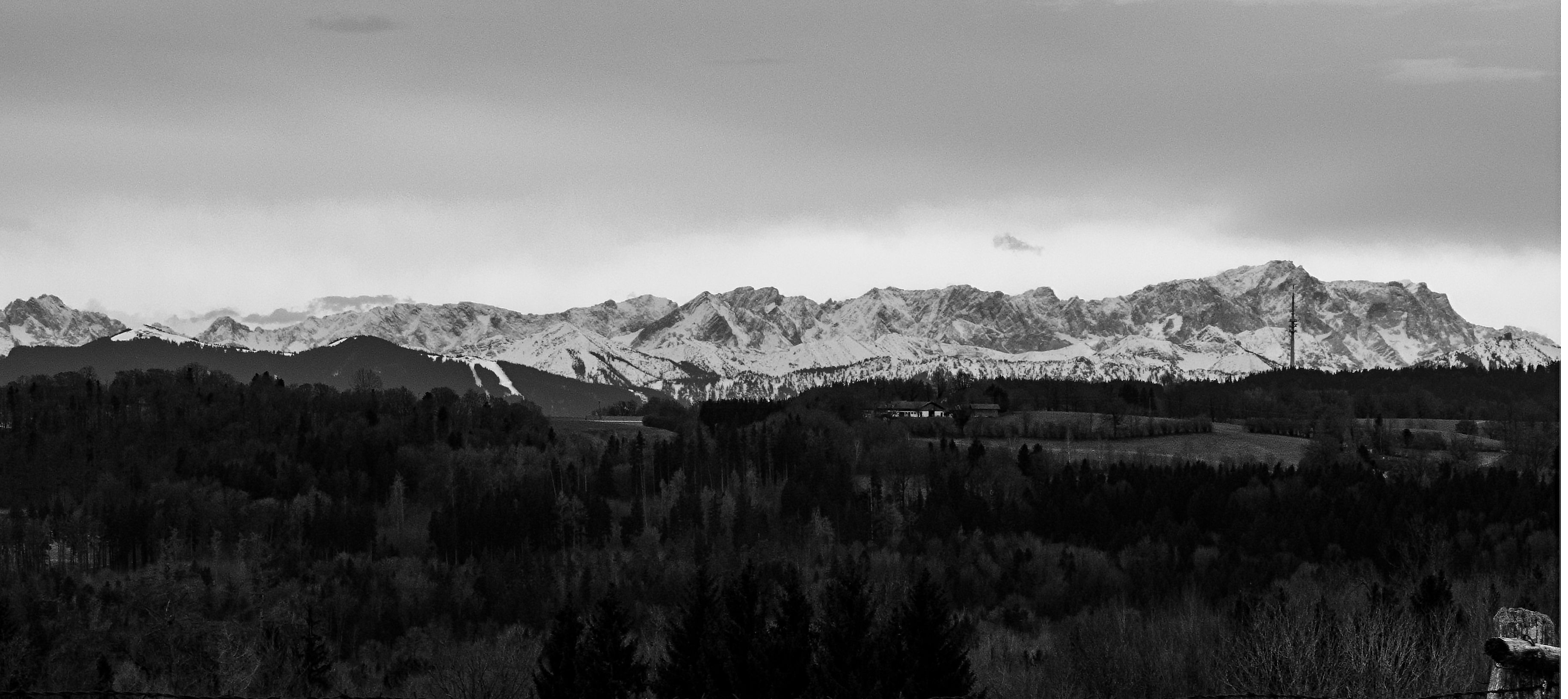
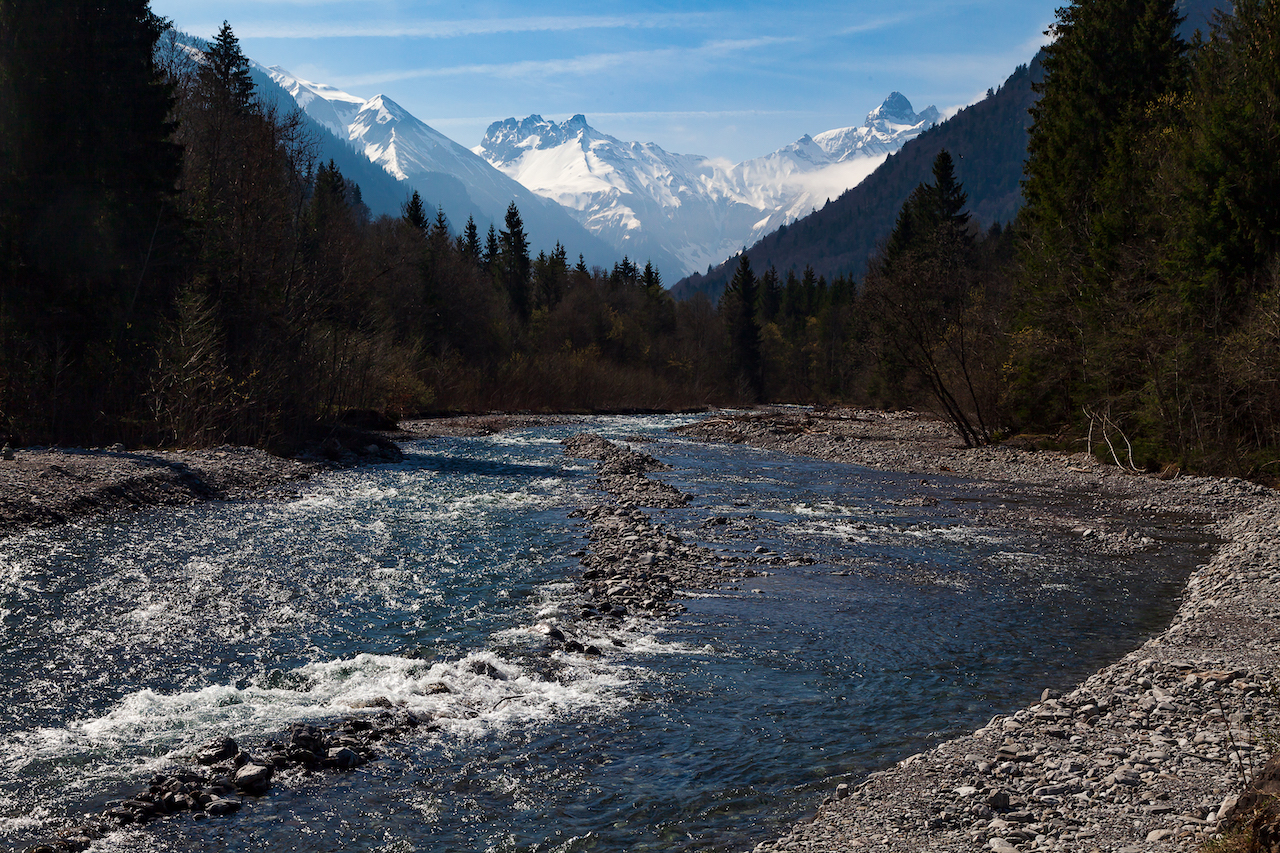
The Oy valley or Oytal is a high alpine valley at the Southern tip of Germany. It is one of the most popular destinations among tourists and hikers staying in Oberstdorf. Trips into the Oytal start straight near the valley station of the Nebelhornbahn ropeway. From here a couple of trails lead towards the Oy valley. One trail leads to the pitoresque Trettach valley first (where the Oy valley begins at a fork) and to a first grand scenic view with the tops of the Allgäuer Alpen in the background. Another trail leads high up over the lower part of the valley and offers many vistas. The Oy valley is top destination also for filmmakers and photographers throughout the year.

Trettach Valley near Oberstdorf

What’s special here is that nobody has to leave the road or very comfortable trails to get to places for fantastic motives for video and photo. There is a road (closed for normal traffic) leading to the Oytalhaus, a traditional mountain inn with excellent food and more spectacular views. You reach this lovely mountain inn after 1 1/2 hours walk.

The trails from the Nebelhornbahn ropeway til the Oytalhaus are no problem for normal walkers and easy accessible. There are no steep climbs. It’s more a continuous ascend. The lower trail beginning at the bridge over the Trettach is called Dr. Hohenadl Weg. It leads through an impressing mountain forest.

After a few bends the high and intimidating high peaks of huge mountains show up. Then the trail reaches an alley with trees which is another unique feature in the Oy valley. During the season a lot of tourists use this road.

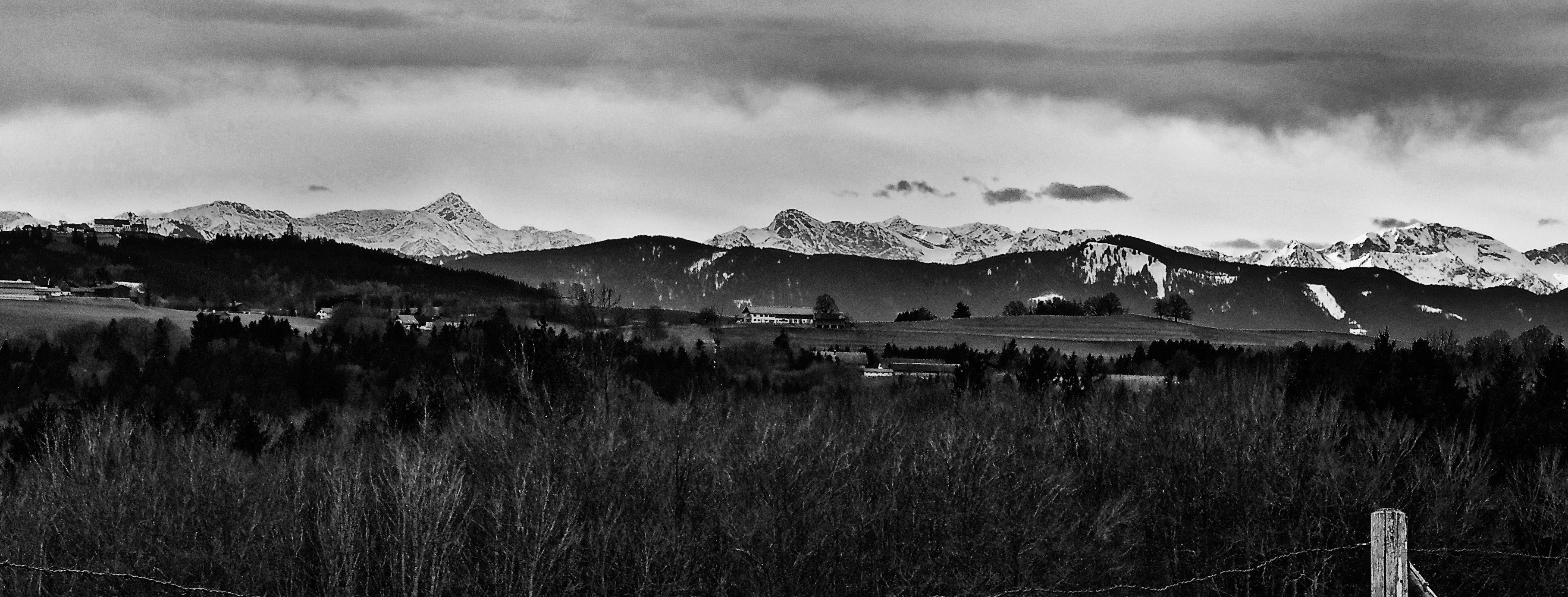
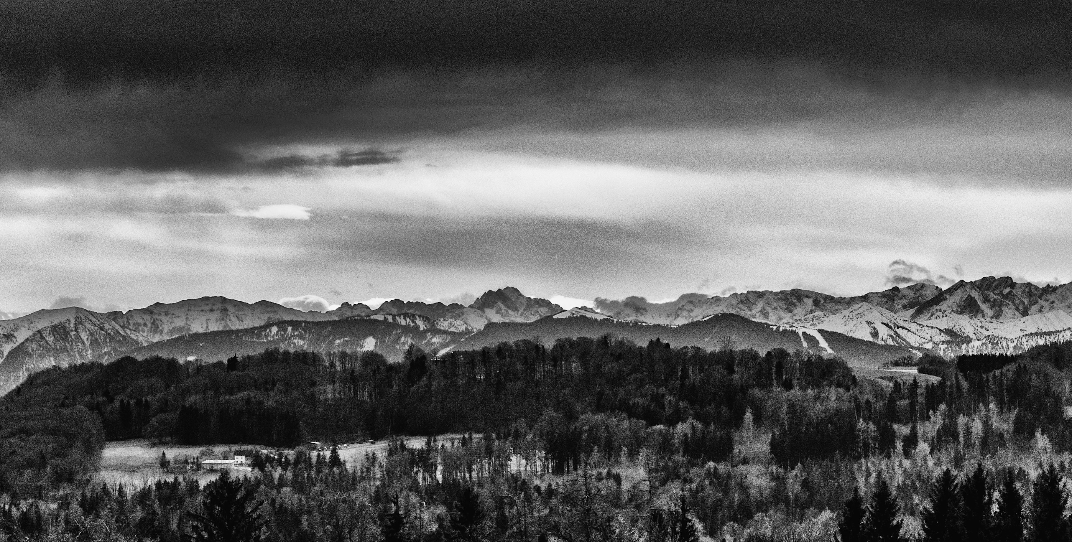
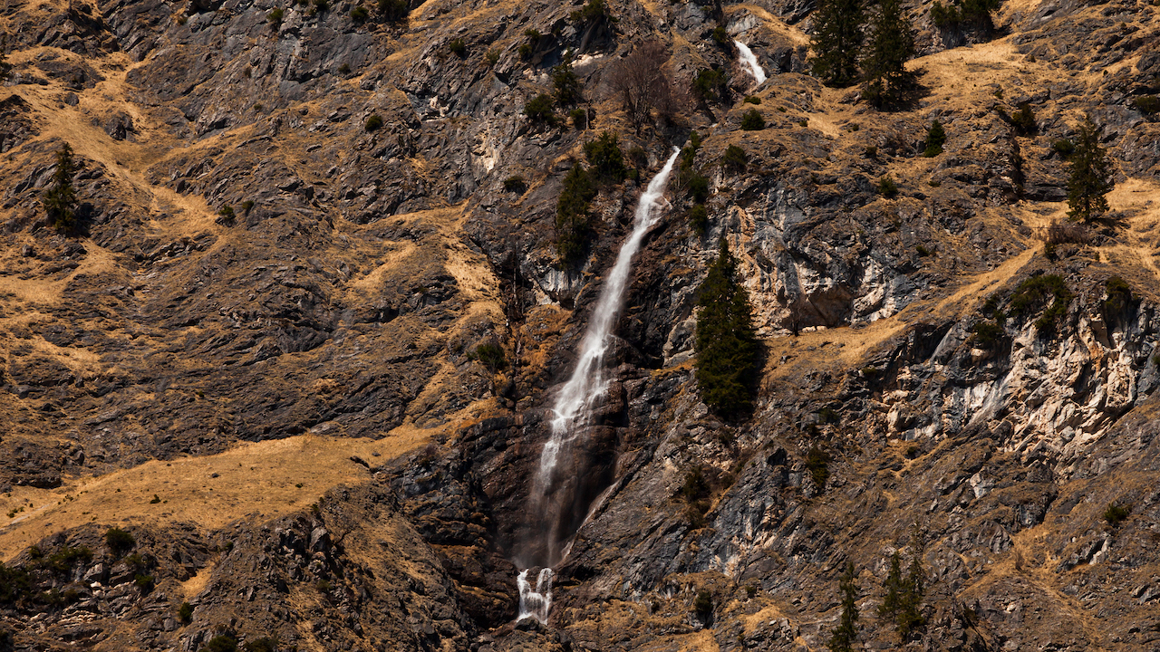
The valley broadens and on the left side the well-known Seebachwand comes into view. It is a huge intimidating rock-face. Here are some water falls and indeed there is one of the highest waterfalls in Europe here right across the Oytal Haus Mountain inn. If you want to takes pictures of the falls the best time is in spring when a lot of water comes down. The water falls in the lower part of the valley are in some distance. It’s good to have a long focal length. Both in spring and autumn you see wonderful colors in this unique mountain wilderness.

Impressive water falls, Seebachwand

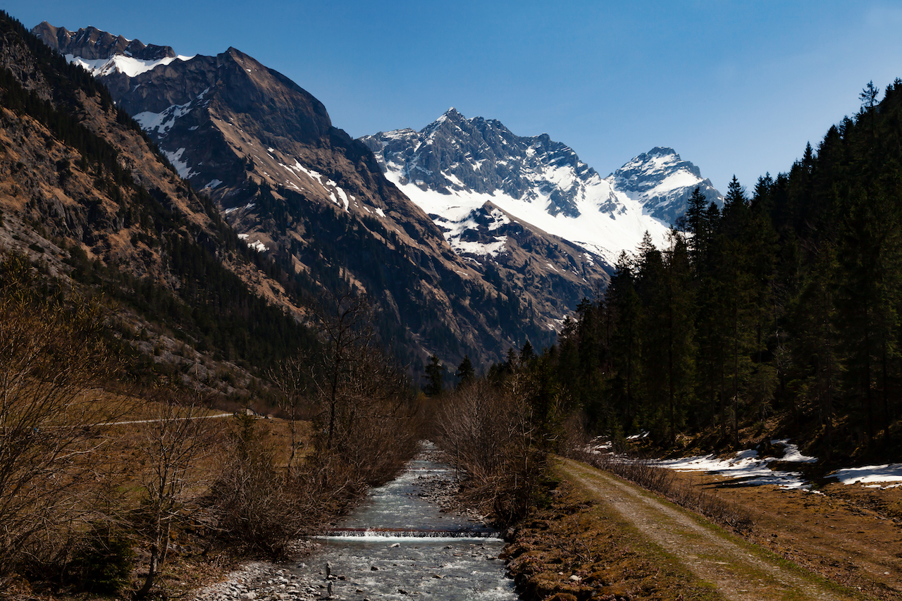
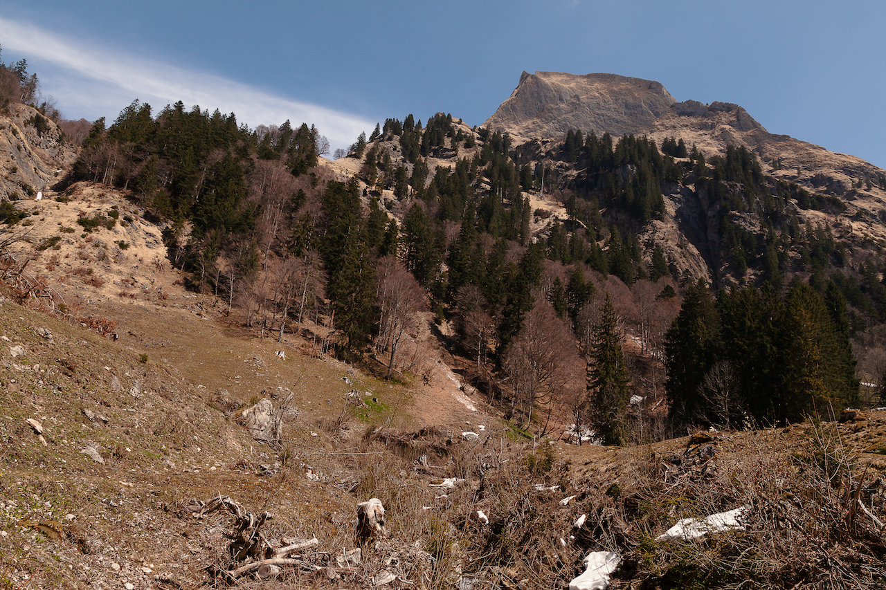
The trail between the Oytalhaus mountain inn and some alpine farms leads to more and more impressive sights of the peaks and their unique shapes. Spring is again a good time as long as the mountain tops are white with snow from the last winter. To the left and to the right there are alpine meadows with rare alpine plants. Please be careful, because this a nature reserve and help to protect animals and these rare plants. There is really plenty to shoot for video and photography straight from the trail.

Oytal Valley

If you want to take pictures and need a quiet atmosphere during the week, for or after the main holiday seasons or on a day with cloudy weather conditions is a good time. During afternoon in summer tourists can rent special scooters for a fast journey back. And there can be a lot of people out there on weekends. There are also plenty of mountain bikers often. Nevertheless there is enough room for anybody to enjoy the fantastic nature.

The trail from the Trettach valley bridge and the Oytal Haus is only part of a much bigger network of trails which lead high up into the mountains. It is for some time still very comfortable (til the next alpine farm) but its lengthy and in the higher part there is a steep ascent. There are more alpine farms up there which offer food and drinks during the summer time. Another huge waterfall is further down the trail (Stuibenfall), which is closer to the trail then the first ones and it looks fantastic, but this is another one and a half hour walk from the Oytalhaus.

In some areas there is still snow in April

A typical thing for these regions are grassy mountains. They should never be underestimated by climbers because they can be very challenging. The region is due to its different type of mountains and the materials they are made of highly interesting for people who are into geology. You see outstanding forms of rock, mountains and different earth ages.

High grass mountain

Good preparation is key as always in alpine terrain. The Oy valley is easy accessible but its good to know about distances (walking times) and what are further options. During summer there is also an exhausting round trip possible with a descend into another mountain valley. However, these might be more for people with a good condition. Weather conditions could change quickly, too.

Sometimes, in spring, water runs in small creeks over the trail in the upper parts of the valley. There might be also snow even in late spring some years in shadowy parts of the valley (proper shoes for hiking strongly recommended). In summer the upper parts are exposed to the sun.

For the high part with mountain peaks and more attractions like the Eissee high above the valley please keep in mind that there are completely different conditions as in the bottom of the valley with comfortable roads and trails. It’s difficult rocky and alpine terrain. It requires experience with hiking in the mountains and it’s a fascinating but also potentially dangerous wilderness region. Tourist offices in Oberstdorf and other towns and villages in the Allgäu-Region can certainly help with good advice. They can tell you also if trails are open or closed or if moutain huts are open. The Oytal trails are accessible by train and by car. There is a huge parking slot near the Nebelhornbahn ropeway station. But it’s great to use the train and the buses, which run frequently.

Naturwunder Sandsteinfelsen in den Nordvogesen

Bizarr geformte Sandsteinkliffs, die von der Sonne angestrahlt, in Rosa und Orange leuchten: Das erwartet man üblicherweise in den Nationalparks in Arizona oder Colorado in den USA. Doch mitten in Europa an der Französisch-Deutschen Grenze befindet sich eine einzigartige Landschaft mit Mittelgebirgen und Bergwäldern, Flüssen, an die hundert Burgen und beeindruckenden Sandsteinformationen. Diese Landschaft wurde von Wind und Wetter geformt und ist 200 Millionen Jahre alt: Das UNESCO Biosphärenreservat Pfälzer Wald und nördliche Vogesen.

verwitterter Sandstein, Burg Falkenstein

Die nördlichen Vogesen befinden sich westlich des Rheins im Nordosten Frankreichs. Sie sind nicht identisch mit den hohen Vogesen weiter südlich. Die nördlichen Vogesen sind Ausläufer des Mittelsgebirges im Alsace. Der regionale Naturpark Nordvogesen existiert seit 1976. Es ist eine besondere Region mit einem unglaublichen Artenreichtum. 65% der Region sind waldbedeckt.

Eine große Attraktion sind die Burgen, die sich oft auf Aussichtspunkten befinden. Diese liegen auf Hügeln oft mit einem beeindruckenden Rundumblick und hier finden man den typischen rotbraunen Sandstein der französischen Vogesen. Es ist ein Sandstein mit mittelgroßen Körnern und eingeschlossenen Steinen, der eine große Rolle beim Bau von Kathedralen und Gebäuden spielte. Dieses Material ist von Wind und Wetter geformt. Das Interessante ist, dass die Sandsteingebilde ständig ihr Aussehen ändern, je nach Sonnenstand oder Lichtbedingungen. Das macht sie zu großartigen Motiven für Fotografen. Auch für alle, die sich für Geologie oder Ergeschichte interessieren, sind sie ein spannendes Thema. Der Regionalpark war 2009 Gewinner der Eden-Competition.

Burg Falkenstein: Mittelalterliches Erbe und großartiger Aussichtspunkt

Die Burg Falkenstein ist ein hervorragendes Ziel: Es ist die gut erhaltene Ruine einer Burg in der Kommune Philippsborg im Mosélle Department. Nach einem ca. 20 minütigen Fussmarsch vom Parkplatz aus erreicht man eine großartige Aussicht, man sieht die Ruinen einer einst großen mittelalterlichen Befestigung und die beeindruckenden Sandsteinformationen.

Der Sandsteinfelsen war tatsächlich Teil der Ritterburg. Die Erbauer schürften Keller und Räume in den Felsen. Die Burg wurde 1127 erbaut und im Dreißigjährigen Krieg zerstört. Jedoch gibt es immer noch eine Menge zu sehen.

Ein Raum, der in den Sandsteinfelsen gegraben wurde.


In den nördlichen Vogesen gibt es auch einen Platz, der “Little Colorado” genannt wird, der Altschloßfelsen in Poppeviller in den Pays de Bitche, ein langgezogenes Sandsteinriff. Das deutsche Pendant zu den nördlichen Vogesen ist das Dahner Felsenland im Pfälzerwald. Touristen, die Frankreich und diese Region besuchen, können sich im “Maison du Parc” in Little Pierre, einer zauberhaften Kleinstadt mit einem beeindruckenden Schloß informieren. Der Tourismus hier ist sehr wichtig: Sowohl die Kommunen wie auch andere Institutionen, zum Beispiel der Club Vosgien unternahm eine Menge Anstrengungen interessierte Besucher zu informieren:

Züge halten in Sarrebourg und Saverne (an der TGV Strecke Paris-Strasbourg). Wichtige Zentren sind Bitche und Sarreguemines. Die nördlichen Vogesen sind auch nicht weit von Saarbrücken entfernt. Die Region ist eine bekannte Wanderregion mit Weitwanderwegen. Auch zum Radwandern eignen sich die Nordvogesen.

In den Nordvogesen herrscht ein halb-kontinentales Klima mit trockenen und heißen Sommern und kalten, schneereichen Wintern. Wie anderer Regionen auch litt die Region unter der Dürre und den Hitzewellen in den Jahren 2018 und 2019.

A miracle of Nature: Pink Sandstone in the Northern Vosges

Bizarrely shaped sandstone cliffs illuminated by the sun in pink and orange: This is something which you usually expect in the US in national parks in Arizona or Colorado. However, in the middle of Europe located on the Franco-German border, there is a unique landscape with low mountain range forests, rivers, 100 castles and impressive sandstone cliffs. A landscape which was formed by wind and weather and 200 million years old: The UNESCO Biosphere Reserve Palatinate Forest (Pfälzerwald) and Northern Vosges.

weathered sandstone, chateau du Falkenstein

The Northern Vosges area is located west of the Rhine in northeastern France. It is not the same as the Vosges mountains or the Haute Vosges. It is the foothills just north of them in Alsace. The regional nature park of the Northern Vosges exists since 1976. It is an extraordinary region with an incredible variety of wildlife. 65% of the area is covered by forest.

A big attraction is the castles which are often located on view-points. These are hills where you have an impressing look and here you often find this intense red-brown coloured sandstone in the French Vosges. It is a mid-grained and pebble bound sandstone which was also important for many buildings as chateaus and cathedrals. The material was formed by wind and weather. The interesting thing is that it looks always different depending on the sun and the conditions of light. It makes a great motive for any photographer. It is also of great interest for anybody interested in geology and history of the Earth. The park was winner 2009 of the Eden competition.

Chateau du Falkenstein: Medieval heritage and a great viewpoint

The chateau du Falkenstein is a great location: It is a ruined castle on top of a hill in the commune of Philippsborg in the Mosélle department. After a walk of 20 minutes from the parking spot, there is great view, the ruins of a once huge medieval castle and very impressing sandstone formations.

The sandstone was indeed part of the castle: The builders carved some caves and rooms in the sandstone rock. The castle was built in 1127 and destroyed in the Thirty Year’s War. However, there is still a lot to see there.

A room carved in the sandstone riff


In the Northern Vosges, there is also a place they call “Little Colorado”: This is the Altschloßfelsen in Poppeviller in the Pays de Bitche, a long sandstone Riff. The German pendant of the Northern Vosges is the “Dahner Felsenland” in the Rhineland Palatinate. Tourists visiting France and this region can get information in the “Maison du Parc” in Little Pierre, a cosy village with an impressing chateau. Tourism is important here: Both the communities and other institutions like the Club Vosgien did a lot of work to inform and guide interested visitors:

Train stops are in Sarrebourg and Saverne (TGV Paris-Strasbourg). Important centres are Bitche and Sarreguemines. The Northern Vosges area is also not far from Saarbrücken. The area is great for hiking and offers long-distance trails. It is also a popular region for cycling.

The climate is semi-continental with dry and hot summers and cold winters with a lot of snow. Like many other areas, the region suffered from the heatwaves and drought 2018 and 2019.

Aussichtspunkt: Hügel bei Wessobrunn in Oberbayern

In Oberbayern gibt es eine endlose Zahl von großartigen Aussichtspunkten. Daher mag die Wahl etwas willkürlich erscheinen. Sicherlich wird es deshalb mehr Plätze geben, die noch portraitiert werden, aber kürzlich habe ich einen Aussichtspunkt entdeckt, der mir wegen der einzigartigen Szenerie besonders gefallen hat. Es ist ein Dorf in der Nähe, Wiesen und Wälder und eine freie Sicht auf die ganze Alpenkette.

(Tip: zum Vergrößern der Bilder auf das Bild klicken)

Der Aussichtspunkt ist gut erreichbar, da er in der Nähe des berühmten Klosters Wessobrunn liegt. Dort befindet sich auch ein Parkplatz etwa einen Kilometer vom Aussichtspunkt entfernt. Dieser ist genau genommen eine schmale Straße und eine Hügelkuppe auf dem Weg nach Diessen am Ammersee.

Ich habe den Aussichtspunkt bei einer Wanderung auf einem Abschnitt des König-Ludwig-2-Wanderwegs entdeckt zwischen Diessen und Wessobrunn. Der Aussichtspunkt ist sicherlich der Höhepunkt dieser Wanderung. Es ist möglich diesen Abschnitt in einem Stück zu gehen und auch zurück (nicht so sehr bei großer Hitze zu empfehlen), jedoch muss man wissen, dass es zwischen Diessen und Wessobrunn keinerlei Einkehr gibt. Aufgrund der Länge der Tour (wenn man sie hin- und zurück macht) ist das eigentlich die ideale Fahrradtour.


Der Sonntag, 11 März, war der erste wirklich warme Tag im Süden Deutschlands (17 Grad) nach einer Perode arktischer Kälte (“Beast From The East”). Das war aber hauptsächlich durch den Föhn verursacht, so wie es manchmal in der Winterhälfte passiert. Der Föhn führt zu einem erstaunlichen rapiden Anstieg der Temperaturen.

Die Luft wird dann sehr klar, und man kann die Berge mit vielen Details sehen. Diesen Tag gab es aber auch ein ganz besonderes Phänomen zu sehen, eine sogenannte Föhnkante. Das ist eine ausgeprägte Grenze zwischen den Wolken und den weniger bewölkten Teilen des Himmels.  Sie entsteht wenn der Föhn zusammenzubrechen beginnt. Folglich war es die nächsten Tage auch kälter und eher wieder wie im Winter.

Im März gibt es noch kaum Grün und wenn die Sonne noch hinter hohen Wolken fast verborgen ist, sind die Farben fürs Fotografieren nicht besonders reizvoll. Aber diese Zeit zwischen Winter und Frühling hat auch ihr Potential: jetzt kann man Strukturen gut in Bildern festhalten.

Als ich eine Weile mit der Bearbeitungssoftware dies und jenes probiert hatte entschied ich mich, diese Serie in Schwarzweiss zu präsentieren. Das ist oft eine interessante Option und kann die besondere Atmosphäre eines Ortes oder eines Motivs erst richtig zum Ausdruck bringen.

Der Trick dabei ist nicht einfach auf Schwarzweiss zu schalten, sondern verschiedene Dinge auszuprobieren mit der Software. Spannende Filter gibt es auch in der NIK-collection Software.

Der Aussichtspunkt ist gut zugänglich wenn man den Parkplatz am “Tassiloweg” hinter dem Kloster Wessobrunn benutzt. Dort geht ein steiler Weg hinauf zur Schloßbergstraße. Die Schloßbergstraße führt zur Siedlung Haid, aber man biegt nicht dorthin ab, sondern folgt dem Weg geradeaus. Es geht bergauf. Die Straße wird sehr schmal (besser nicht mit dem Auto dahin fahren, es gibt keine Parkmöglichkeit). Es ist auch zudem ein sehr schöner Spazierweg vom Kloster Wessobrunn aus. Am Ziel findet man auch eine Parkbank. Ein großartiger Platz für eine Rast und selbstverständlich zum Fotografieren.

/a>


Dieser Aussichtspunkt ist nicht mehr weit vom Hohen Peissenberg  entfernt. Beide Plätze eignen sich hervorragend zur Wetterbeobachtung und zur Wetterfotografie. Der Platz bei Wessobrunn könnte auch speziell für Sonnenaufgang und Sonnenuntergang sehr spannend sein. Er präsentiert jedenfalls eine ganz typische oberbayerische Landschaft.

KelbyOne. Learn Photography from the World's Best Instructors.

Der dominanteste Berg in der Siluette ist natürlich die Zuspitze. Vom Aussichtspunkt in Wessobrunn hat man direkt davor den Hohen Peissenberg mit der großen Antenne im Blick. Es ist gut so einen Tag wie diesen Föhntag zu erwischen um die ganzen Details einzufangen. Die niedrigeren Berge im Vordergrund und die großen Gipfel im Hintergrund erlauben Bilder mit einer besonders plastischen Tiefe, wenn die Luftbedingungen passen.

Das Bild oben ist am Aussichtspunkt aufgenommen und zeigt den Hohen Peissenberg. In der Mitte ist die Wallfahrtskirche, auf der rechten Seite ist ein kleiner Turm, der Teil der Wetterstation des Deutschen Wetterdienstes ist. Auf der linken Seite und auch auf dem Bild darunter ist die große Antenne zu sehen.